
 Home
Essential Grand Canyon Facts You Didn't Know (But Should Before Visiting)
Most travel guides reduce the Grand Canyon to a list of superlatives and call it a day. What they rarely convey is the staggering complexity hiding behind those numbers. At 278 miles long and more than a mile deep, this geological phenomenon exceeds Rhode Island's entire landmass — a fact that registers differently once you're standing at the rim, staring into an abyss that seems to have no end. The park itself commands 1,904 square miles, draws between 4.5 and 5 million visitors a year, yet an estimated 90% of them never venture below the rim. They experience a fraction of what this place truly holds. The canyon's geography, its layered history, and the life thriving within its depths — these are the details that genuinely shape what kind of visit you'll have.

Location Facts That Shape Your Trip
Where Is the Grand Canyon Exactly
Grand Canyon National Park occupies the northwest corner of Arizona. The Colorado River carves through it, fed by tributaries spanning seven states, yet every inch of the canyon itself falls within Arizona's boundaries — precisely at coordinates 36°18′35.64″ North, 112°47′00.60″ West.
Distance from major cities determines, for most visitors, which rim they'll ever see. The South Rim sits roughly 4 hours from both Phoenix and Las Vegas. The North Rim demands considerably more commitment — approximately 5 hours from Las Vegas and 6 hours from Phoenix. That logistical gap explains nearly everything about visitor distribution across the park.
How Big Is It Really
The canyon's length is 278 miles, but its width tells a more interesting story. At Marble Canyon, the narrowest passage, the two walls stand just 600 feet apart. At its widest, the canyon stretches 18 miles from rim to rim, with an average width of 10 miles throughout. Depth at its most extreme reaches 6,093 feet — over a mile of exposed geological time stacked beneath your feet.
The Colorado River, responsible for all of this, runs 1,450 miles total, originating in the Rocky Mountains before emptying into the Gulf of California. Six million years of that river's persistence, combined with steady geological uplift, produced what stands here today.
North Rim vs South Rim: Two Entirely Different Canyons
Elevation separates these two experiences before anything else does. The North Rim sits at 8,000 feet above sea level; the South Rim averages 7,000 feet. That single 1,000-foot difference supports a mixed-conifer forest of ponderosa pine, Douglas fir, white fir, Engelmann spruce, and aspen on the north side — vegetation that feels entirely out of place for a canyon most people associate with desert heat.
The South Rim operates year-round and absorbs 90% of all park visitors. The North Rim closes between October 15 and May 15, when heavy snowfall makes access untenable. Only 10% of visitors ever reach it.
Infrastructure reflects this imbalance sharply. The South Rim offers paved roads, a free shuttle system, hotels, restaurants, and viewpoints at nearly every turn. Since the 2025 Dragon Bravo Fire destroyed the historic Grand Canyon Lodge, the North Rim offers no overnight lodging. Visitors can only camp at the North Rim Campground or Cottonwood Campground, and services are far more limited.
What consistently surprises visitors: the two rims appear deceptively close on any map. Driving between them covers 212 to 220 miles and consumes 4.5 to 5 hours. No road bridges the canyon itself. Hiking rim to rim spans 21 miles and, done properly, takes three days.
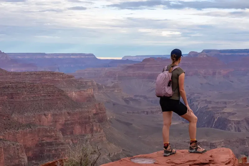
Summer temperatures underscore the contrast further. The South Rim's lower elevation and sparse tree cover push temperatures considerably higher, while the North Rim's altitude keeps summer highs below 80°F with reliable consistency. From the South Rim, the Colorado River is visible from several vantage points, with the canyon's depth commanding the view. The North Rim shifts that perspective — wider vistas dominate, and the river itself only appears as a sliver glimpsed through Angel's Window.
The Science You Can See With Your Eyes
Two Billion Years in Layered Rock
Few places on Earth expose geological time as visibly as the Grand Canyon. The rocks at the canyon's base began forming nearly two billion years ago — igneous and metamorphic formations compressed deep within the inner gorge, representing the oldest layer the human eye can observe. Rising above them, successive bands of sedimentary rock chronicle entirely different environmental epochs, each stratum a preserved record of ancient seas, desert dunes, and river deltas that no longer exist.
Geologists apply the principle of superposition to read this sequence: the oldest layers sit at the bottom, each subsequent layer deposited atop the last. Rocks at the rim are the youngest. Tilted layers signal geological disruption — evidence that some significant event deformed them after their original horizontal formation.
The most counterintuitive detail of all: the canyon is far younger than the rocks it exposes. Those basement formations are 1.8 billion years old, yet the Colorado River has only been cutting downward for five to six million years. The canyon is, geologically speaking, a recent wound in ancient stone.
The Colorado River's Ongoing Work
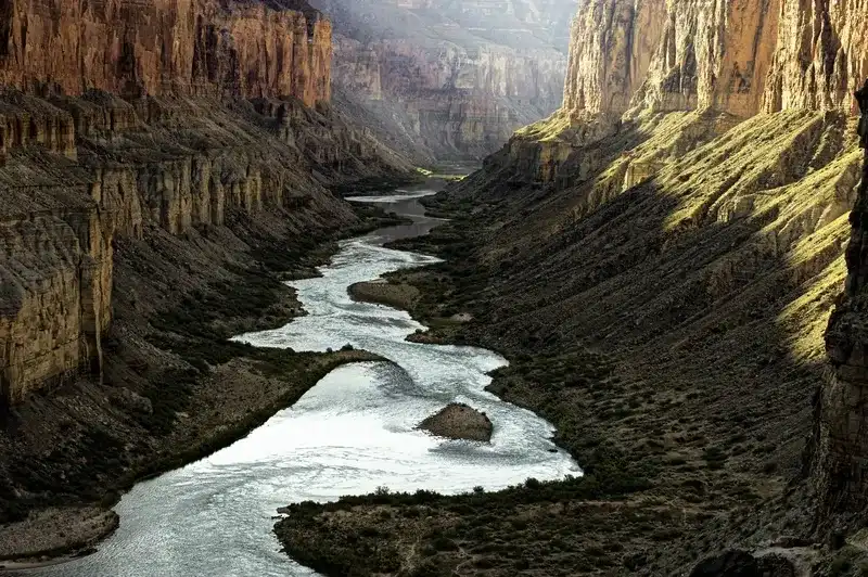
The river's role here was never passive. Through a process called downcutting, the Colorado physically chiseled its path into the plateau. Floodwaters don't merely rush through — they carry boulders and cobbles that grind against the riverbed like natural cutting tools, prying loose material as they travel.
Three measurable forces make this downcutting unusually aggressive. The river descends approximately 2,000 feet in elevation across its 278-mile journey through the canyon, generating swift currents strong enough to transport substantial rock. Under normal conditions, it runs 300 feet wide and 40 feet deep, pushing between 12,000 and 15,000 cubic feet of water per second. Flood events amplify this to 300,000 cubic feet per second — a figure that makes the canyon's depth feel less mysterious.
The surrounding arid climate compounds the effect. Sparse vegetation leaves bedrock exposed to precipitation, dramatic temperature swings, and winter ice-wedging, all of which fracture and loosen rock surfaces that the river eventually carries away.
Strange Weather Patterns Inside the Canyon
The canyon generates its own climatic logic, one that baffles visitors who arrive without understanding elevation's role. The most extreme recorded temperatures — -22°F on the North Rim and 120°F at Phantom Ranch on the canyon floor — occurred within the same park. The distance between those two points is measured in vertical feet, not miles.
The rule holds consistently: for every 1,000 feet of descent, temperature rises 5.5°F. The North Rim, sitting at 8,297 feet, receives about 24 inches of precipitation annually. Phantom Ranch, nearly 6,000 feet lower at about 2,400 feet, sees less than an inch of snow.
Mid-summer brings monsoon conditions across the Southwest. Heat building over desert terrain pulls moist air northward from the Gulf of California, producing storms that develop with little warning. Flash floods are a particular hazard — water can surge through the canyon bottom before a single drop of rain reaches rim level.
Why the Air Here Is So Clean
Thanks to its remote location on the Colorado Plateau, the Grand Canyon enjoys some of the clearest air in the Southwest. For a destination this heavily visited, that clarity reflects both its isolation and the sustained effort to protect the region’s air quality.
Creatures and Plants That Call It Home
Animals Found Nowhere Else on Earth
Seventeen animal species exist exclusively within Grand Canyon National Park — a figure that speaks to just how isolated and ecologically singular this landscape truly is. The Kaibab squirrel is one of the region’s most famous endemics. It lives only on the Kaibab Plateau, both inside the park and in the neighboring Kaibab National Forest, and survives on a remarkably narrow diet: ponderosa pine cones for sustenance, ponderosa branches for shelter. Its dark body, tufted ears, and conspicuously bright white tail make it one of the more visually striking residents of the park.
The Grand Canyon pink rattlesnake takes exclusivity further still — this subspecies of the Western rattlesnake exists nowhere else on the planet. Its blotches of pink, red, and brown render it almost invisible against the canyon's layered rock faces, an adaptation so precise it reads less like coincidence and more like geological partnership. It shares the park with five other rattlesnake species. Five endemic butterflies, one endemic tarantula, and one endemic pseudoscorpion round out the list of creatures found only here. The Kaibab swallowtail butterfly, restricted to the North Rim, is identifiable by its black wings edged with shimmery blue — subtle, but unmistakable once you know what to look for.
The Dangerous Wildlife You Should Know About
The animal responsible for sending more visitors to the hospital than any other here is not the rattlesnake or the scorpion. It's the rock squirrel. These gray-brown, bushy-tailed creatures look entirely benign, which is precisely why dozens of people get bitten every year attempting to hand-feed them. The consequences can be severe — rock squirrels can carry fleas that transmit bubonic plague, and their bites can lead to serious infections.
Park guidelines recommend maintaining at least half the length of a bus between yourself and any small animal. For elk, double that distance. These animals exceed 300 kilograms, grow unpredictable during mating season in September and October and equally so when protecting calves in May and June. Bison, found exclusively on the North Rim, demand 100 feet of clearance at minimum — they can approach nearly a ton in weight and cover ground faster than most people expect. When they graze within 100 feet of a road, the vehicle becomes your best vantage point.
The Arizona bark scorpion completes this cast of hazardous residents. The most venomous scorpion on the North American continent, it measures roughly 2.5 inches in length and fluoresces bright blue under UV light — a detail that seems almost theatrical for something so genuinely dangerous. Nocturnal by habit, it favors riparian zones but ranges throughout the park.
From Desert Floor to Alpine Forest
What makes the Grand Canyon's ecology particularly compelling is its vertical range. Five distinct ecosystems stack atop one another according to elevation, each supporting an entirely different cast of species. At the North Rim's highest reaches, the boreal forest endures 11 feet of snowfall annually, sheltering aspen, Douglas fir, and Engelmann spruce. The full park tally stands at 450 bird species, 91 mammal species, and 1,737 vascular plant species — numbers that reflect the consequence of compressing multiple climate zones into a single landscape.
The canyon floor tells a different story. The desert scrub ecosystem occupying the inner gorge is the hottest, driest zone in the park, home to six rattlesnake varieties, including the diamondback. Bighorn sheep roam these lower reaches and demonstrate a physiological resilience that's difficult to overstate — they can go weeks without water when conditions demand it. Between these extremes, riparian corridors trace the Colorado River, fed by constant water and supporting cottonwood stands alongside species like the canyon tree frog, which lives in rocky canyon streams across the Southwest.
Over 1,000 Caves Most People Never See
Beneath the canyon's visible surface lies another world entirely. The park holds over 1,000 caves, though only 335 have been formally recorded, and the proportion that has been explored, mapped, or inventoried is smaller still. The Cave of the Domes on Horseshoe Mesa stands as the sole cave accessible to visitors.
These subterranean chambers serve purposes that extend well beyond curiosity. They offer stable refuge for bats and other wildlife as surface conditions shift across seasons. Many function as conduits for freshwater springs — a quiet but critical contribution, supplying clean drinking water to Indigenous communities and park visitors alike.
Most visitors spend 1-2 days at the South Rim to see the main viewpoints and take short walks along the rim. If you want to hike below the rim or visit both the North and South Rims, plan for at least 3-4 days. Keep in mind that driving between the two rims takes 4.5 to 5 hours, covering over 200 miles, even though they look close on a map.
Yes, Supai Village sits at the bottom of Havasu Canyon with a population of 208 people, making it the most remote community in the contiguous United States. The village is accessible only by hiking, helicopter, or mule, and sits eight miles from the nearest road. Mail is still delivered to residents by mule train six days a week.
The Kaibab squirrel is one of the rarest animals in the park, found exclusively on the North Rim's Kaibab Plateau and nowhere else on Earth. You can identify it by its dark body, distinctive tufted ears, and bright white tail. The Grand Canyon pink rattlesnake is another species that exists only within the park boundaries.
Hundreds of people need rescue at the Grand Canyon every year. The park recorded 232 search-and-rescue incidents in 2025. While specific fall statistics aren't widely published, heat-related incidents are particularly common, with multiple deaths occurring each summer when temperatures at the canyon bottom exceed 120°F. Rangers strongly recommend avoiding inner canyon trails between 10 a.m. and 4 p.m. during hot months.
Only 10% of the nearly 5 million annual visitors venture below the rim due to the extreme physical demands and safety concerns. Hiking to the canyon floor requires descending 4,700 feet and then climbing back up in temperatures that can exceed 120°F. Additionally, overnight stays require permits that cost $10 plus $15 per person per night and must be obtained through a competitive lottery that closes four months before your trip’s start month.
Customize Your Dream Vacation!
Get in touch with our local experts for an unforgettable journey.
Plan Your TripStories From the Canyon's Past
12,000 Years of Human History
Human presence at the Grand Canyon reaches back at least 12,000 years — deep into an era when the continent still belonged to creatures that no longer exist. Paleo-Indians arrived during the final stages of the last Ice Age, armed with Clovis and Folsom point spears, hunting woolly mammoths and saber-toothed cats across terrain that would have looked nothing like the arid canyon visitors encounter today. Stone tools, charred hearths, and rock shelters scattered across the canyon tell the story of how these earliest inhabitants endured conditions that would challenge any modern expedition.
The Ancestral Puebloans left a more visible archaeological record, occupying the canyon between 500 CE and 1200 CE. Stone granaries and cliff dwellings — some of which canyon hikers can still spot from the trails — speak to a people who didn't simply inhabit this place but actively managed it. They engineered water-control features, cultivated agricultural plots, and wove the canyon into a trade network that extended across the entire Colorado Plateau. Their departure around 1200 CE wasn't an erasure. Their descendants became the modern Hopi, Zuni, and other Pueblo peoples, who maintain living, ceremonial connections to these ancestral sites to this day.
The Hoax That Still Sparks Conspiracy Theories
On April 5, 1909, the Arizona Gazette ran a story that would fuel speculation for more than a century. Explorer G.E. Kinkaid, the article claimed, had discovered a cave deep within the canyon walls, filled with Egyptian artifacts. The piece described hundreds of Egyptian-style relics and named Smithsonian professor Jordan as leading a formal expedition into the site.
The story drew little attention at the time and was soon forgotten. When it resurfaced decades later, it quickly fell apart under scrutiny. No photographs of the artifacts existed. The Smithsonian held no record of receiving Egyptian artifacts from the canyon. Neither Kinkaid nor Professor Jordan had any employment connection to the institution whatsoever. When the Smithsonian conducted formal searches of its staff records in both 1995 and 2000, no employees by the names G.E. Kinkaid or S.A. Jordan appeared anywhere in their documentation. The cave, the relics, and the expedition existed entirely within the pages of that single newspaper article.
How a Photography Business Thrived at the Rim in the 1900s
Ellsworth Kolb reached the South Rim by train in 1901. His brother Emery followed in October 1902, and by 1903 the two had established a photography business near Bright Angel Trailhead after securing permission from Ralph Cameron. What followed was one of the more remarkable commercial operations in the canyon's recorded history.
The brothers' method was punishing by any measure. After photographing mule riders at the trailhead, Emery would sprint 4.5 miles down the trail to Indian Garden (now Havasupai Gardens), develop the film in spring water, and race back up the trail to sell finished prints to the same tourists who had just descended. Water wasn't piped from Indian Garden to the South Rim until 1930, so their trailside darkroom, built in 1906, kept the business running for about 24 years. Kolb Studio operated for 72 years, from 1904 until Emery died in 1976, a testament to what two determined brothers built at the edge of one of the world's most inhospitable landscapes.
Supai Village: America's Most Remote Community
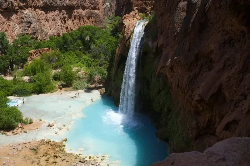
Eight miles from the nearest road, at the floor of Havasu Canyon, sits Supai Village. The U.S. Department of Agriculture designates it the most remote community in the contiguous United States — a population of 208 people accessible only by foot, helicopter, or mule.
Mules carry the mail here six days a week. Each piece receives a distinctive "Mule Train" postmark, a small artifact of a postal tradition that persists well into the modern era. The service originates 75 miles away in Peach Springs before sunrise, with the mule train descending to the village in three hours and requiring five hours to climb back out.
The FAA Was Created Because of This Place
June 30, 1956, produced the worst midair collision in American aviation history to that point. A TWA Super Constellation and a United Airlines DC-7 struck each other above the canyon, killing all 128 people aboard both aircraft. The collision occurred in uncontrolled airspace, where pilots bore sole responsibility for maintaining separation between aircraft—a system already straining under the dramatic growth of commercial aviation.
The catastrophe became a defining argument for federal intervention. Congress passed the Federal Aviation Act of 1958, stripping the Commerce Department of its oversight role and establishing what became the Federal Aviation Agency. The skies above the Grand Canyon, already among the most spectacular on the continent, had also become the catalyst for the regulatory architecture governing every commercial flight that followed.
What You Must Know Before Setting Foot Below the Rim
Why Only 10% of Visitors Go Below the Rim
The viewpoints along the rim are spectacular, but they represent the canyon's most forgiving offering. Descending to the canyon floor means dropping 4,700 feet — then climbing every one of those feet back out. The round trip demands far more from the body than most visitors anticipate, and hundreds of people need to be rescued each year (232 search-and-rescue incidents in 2025). Access is further restricted by a permit system and scarce accommodation at Phantom Ranch and Bright Angel Campground, both of which fill up months in advance. The canyon doesn't reward impulsive planning.
Heat Claims Lives Here Every Summer
Canyon bottom temperatures regularly exceed 120°F in summer. This is not an abstract warning. June 2026 alone recorded four hiker deaths from heat-related illness. A 72-year-old hiker died on the South Kaibab Trail on June 12. Four days later, two more hikers died on the North Kaibab Trail during an extreme heat warning, with temperatures near 110°F at Phantom Ranch. Rangers consistently advise against hiking inner canyon trails between 10 a.m. and 4 p.m. during hot months — advice that far too many visitors dismiss.
The Permit System Explained
Overnight stays below the rim are not simply a matter of booking a campsite. A backcountry permit is required, priced at $10 plus $15 per person per night. These permits are allocated through an Early Access Lottery. It opens on the 16th of the month, five months before your start month, and closes on the 1st, four months before. Up to 750 applicants are given a date and time to make their reservation. Treating this as an afterthought guarantees disappointment.
A 12.5-Mile Lifeline Running Beneath the Canyon
Every drop of water reaching the South Rim travels through the Transcanyon Waterline, a 12.5-mile pipeline constructed in the 1960s. Since 2010, that aging infrastructure has suffered over 85 major breaks, with a single repair often costing more than $25,000. A $208 million replacement project broke ground in 2023 and is expected to finish in October 2026 — a necessary reckoning with decades of deferred maintenance on a system that the entire South Rim depends upon.
One Common Misconception Worth Correcting
The Grand Canyon holds many genuine claims to distinction, but the title of world's deepest canyon is not among them. Hells Canyon, on the Idaho–Oregon border, is deeper, and the world’s deepest canyon is the Yarlung Tsangpo Grand Canyon in Tibet. Knowing this doesn't diminish what the Grand Canyon is — it simply separates myth from the far more remarkable truth.
Conclusion
What the Grand Canyon demands, above all else, is respect — for its scale, its history, and the very real dangers concealed within its extraordinary beauty. The figures are sobering: hundreds of rescues each year, summer temperatures that have claimed lives on well-traveled trails, and a water infrastructure aging faster than it can be repaired. These aren't footnotes. They are the defining conditions of a visit.
The canyon rewards those who arrive with genuine curiosity and careful preparation. Its 1.8-billion-year geological record, its seventeen species found nowhere else on Earth, its 12,000-year human history — none of it reveals itself to the unprepared eye. The 90% who never leave the rim see something magnificent. The 10% who descend into it see something altogether different.
The canyon has been here for six million years. It will outlast every guidebook ever written about it. What changes is simply how much of it you're ready to understand.
Discover New York City like an insider. This guide covers the best time to visit, where to stay, how to budget, and how to get around by subway, plus must-see landmarks and restaurants worth your time.
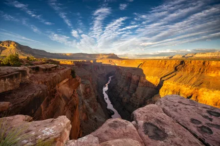
From 1.8-billion-year-old rocks and wildlife found nowhere else to heat risks, permits, and the North Rim’s post-fire changes, these are the Grand Canyon facts every visitor should know before arriving.

Philadelphia has much more to offer than Independence Hall and the Liberty Bell. This guide takes you to the neighborhoods locals love, the best cheesesteak spots, budget-friendly BYOB restaurants, and smart tips to save money and skip the crowds.
Niagara Falls NY offers far more than a quick photo stop. Explore America’s oldest state park for free and get close to the American and Bridal Veil Falls. Ride the Maid of the Mist, walk Goat Island, and discover the history, science, and practical tips that make your visit unforgettable.

The White House has a past far stranger than its famous facade suggests. It was built partly by enslaved workers, burned by British troops in 1814, and rebuilt more than once. Below its best-known rooms are a sealed swimming pool and a wartime bunker.
